
 The following pages are taken from A Descriptive Narrative of the Earthquake of August 31, 1886 by Carl McKinley for the Charleston City Year Book 1887.
Specifically, these pages report the effects of the earthquake around the state of south Carolina. The epicenter was 20 miles north of Charleston, but the quake was felt across the east coast north to Chicago and south to Miami.
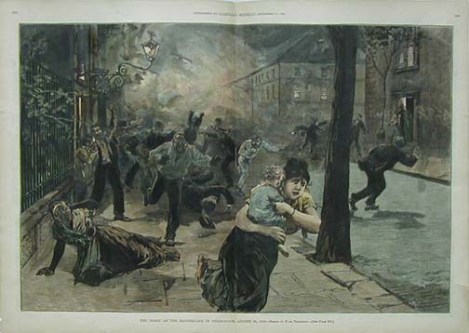
People fleeing the earthquake’s destruction on the night of Aug. 31, 1886. Image from Harper’s Week

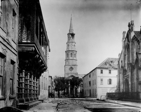
Church Street damage: Dock Street Theater (left); St. Philip’s Church (center); French Huguenot Church (right)


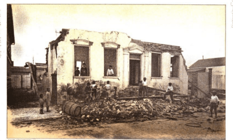
Broad Street … 27 Broad Street with crumbled facade


Hayne Street (looking east from Meeting Street)


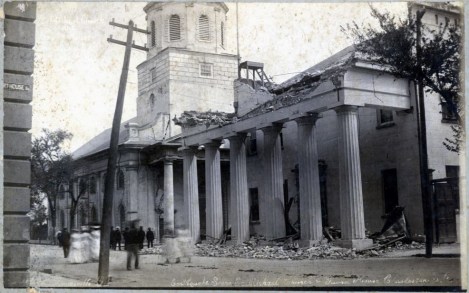
St. Michael’s Church and City Guard House

Food lines, from Harper’s Weekly

Washington Square became a refugee camp for hundreds of residents whose home were destroyed.
